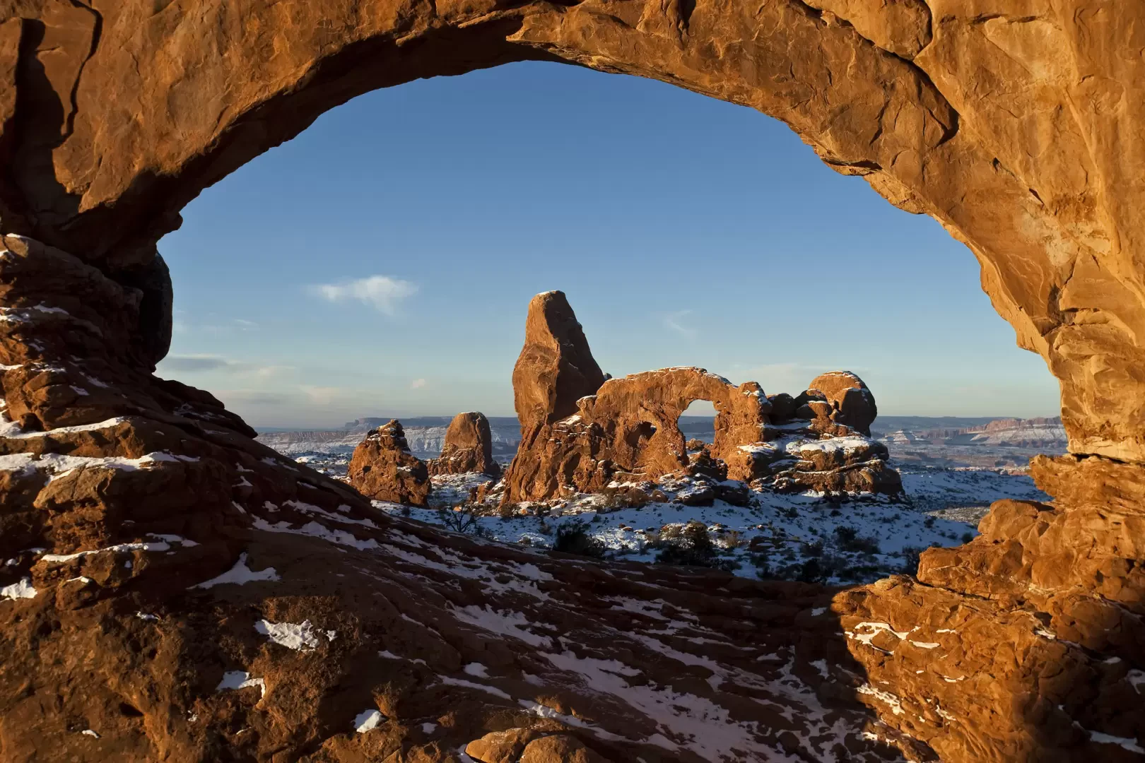
Arches National Park

Access
The main access point to the park is located on US Highway 191, about 6 km north of the town of Moab. Moab is served by road links and is the reference point for tourist services, supplies and accommodation. The visitor centre is located at the entrance to the park and ample parking is available. There is no direct public transport service within the park, so the use of a private car is recommended. The most popular trails are signposted and the main car parks are located at the entrances to the areas of interest; in less-travelled areas, parking may be limited. During the summer season, temperatures can exceed 40°C and the trails are affected by strong sunlight; in winter there may be snowfall and occasional closure of some roads and trails due to ice or risk of erosion. The best time to visit is in spring and autumn, when the weather conditions are most favourable for hiking.
Introduction
Arches National Park is located in the southeastern region of Utah, in Grand County, a few kilometres from the town of Moab. It covers an area of about 310 square kilometres in the heart of the Colorado Plateau. This national park represents one of the most geologically and scenically interesting protected areas in the United States, famous for the highest concentration of natural rock arches in the world: more than 2,000 catalogued formations. The morphological variety is flanked by pinnacles, monoliths, balancing boulders and canyons with vivid reddish colours that vary with the incidence of light during the day. The predominantly semi-desert environment is characterised by an arid climate with precipitation of less than 250 mm per year and large seasonal temperature fluctuations.
Description
The ideal route within the park follows the Scenic Drive, a scenic road about 29 km long that offers direct access to the main points of interest. The route traverses ever-changing landscapes: from the vertical monoliths of the Courthouse Towers area, devoid of arches but with an imposing profile, to large canyons such as Park Avenue, where rock walls soar like natural skyscrapers and offer spectacular perspectives. Park Avenue can be reached via an easy, level paved path that runs along the canyon for about 1.6 km.
Continuing on, one encounters some of the most iconic formations: Delicate Arch, depicted on Utah's automobile number plate, can be reached via a 4.8 km round-trip trail. Landscape Arch, at 88 metres long, is one of the largest arches in the world and can be observed via a short hike in the Devils Garden section. Balanced Rock, a huge boulder seemingly precariously balanced, represents one of the most incredible examples of selective erosion. The Fiery Furnace area, on the other hand, is characterised by narrow canyons and red sandstone pinnacles, where access is only regulated by guided tours for conservation reasons.
The terrain varies between bare rocks, sandy deserts, mixed meadows and ephemeral pools; the vegetation is dominated by xerophilous species and the fauna includes lizards, wild rabbits, birds of prey and some small mammals adapted to the harsh conditions. Not to be overlooked is the possibility of spotting wild spring flowers and observing the colour variations of the rocks during the day, from bright red to orange, pink, yellow and white. The geological formations are the product of millions of years of deposition, tectonic uplift and erosion: the current morphology is mainly due to the action of wind, rainwater and the freezing/thawing processes typical of desert climates. Numerous excursion itineraries of varying difficulty and length make it possible to explore the park; a permit is required for excursions in the less signposted and wilder areas.
Among the curiosities, the presence of arches of different morphology and size, from the smallest to the most monumental, is noteworthy; Broken Arch, despite its name, is not really broken but shows a characteristic crack at the top that accentuates its uniqueness. The formations are still subject to the process of erosion: some arches have collapsed over the past decades, while others are in the process of formation. Historically, the region was inhabited by Amerindian peoples, whose presence is evidenced by pictographs and rock carvings.
Naturalistically and scenically significant neighbouring parks include Canyonlands National Park, Dead Horse Point State Park and Colorado National Monument.
Information
Founding Year: 12/04/1929
Surface Area: 309 sq. km
Maximum Elevation: Elephnat Butte (1745m)
Institutional Site: www.nps.gov/arch/index.htm