Bionaz Alpine Group mountain hut, from Les Rus


Edited by:
Massimo Martini
Updated at: 28/06/2026
Access
Road directions
⚠️ The tunnel on the is temporarily closed for works until the end of June 2027. Alternatively, exit the at the Aosta Est toll booth, follow the towards the centre of Aosta and continue to Signayes to join the towards Bionaz.
Leave the motorway at the Aosta Est toll plaza, turn right and join the expressway for 8.4 km (8.4 km). At the tunnel exit, after 130m, turn slightly right onto the regional road towards Bionaz. At the roundabout, take the second exit and continue along the regional road through the villages of Valpelline and Oyace. After 17.6 km (26.0 km), you will reach the village of Dzovennoz. Turn left towards Les Rus and follow the local road for 1.3 km (27.3 km) until you reach the car park.
Car park
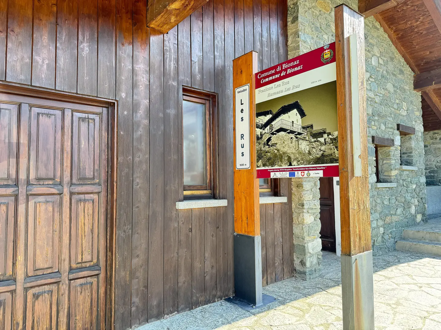
At the end of the local road is the free 🅿️ car park just before the village of Les Rus, the starting point of the route.
Access by public transport
The nearest bus stop to the starting point is in Dzovennoz, which can be reached by SVAP 🚌 buses (Aosta–Bionaz line). For up-to-date timetables, visit www.svap.it. From the Dzovennoz bus stop, continue on foot along the local road for 1.3 km to the Les Rus car park.
Distance and journey time
🕒 Journey time: 39 minutes
📏 Distance: 27.3 km
GPS navigation
Important information
The directions provided were verified on the date the route was mapped. Before setting off, we recommend checking for any changes to the route or road conditions. For up-to-date information, please consult Google Maps or Apple Maps.
Introduction
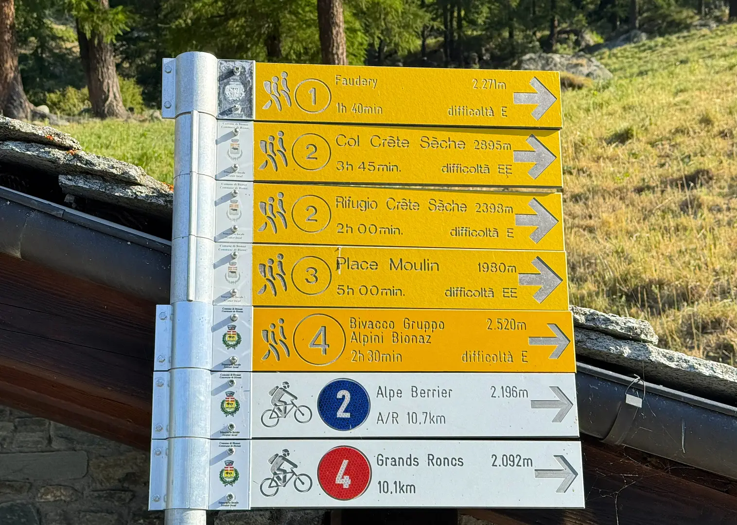
A partial circular route in the municipality of Bionaz, in the upper Valpelline, including an ascent to the Gruppo Alpini di Bionaz bivouac (2,520 m) via the mountain pastures on the left bank of the Crête Sèche stream, returning to Les Rus via the path descending from the Crête Sèche mountain hut (2,389 m).
The route alternates between larch forests in the lower section, farm tracks and mountain pastures in the middle section, and open terrain in the upper section. During the ascent, you will come across the Berrio di Governo, a boulder that, in the second half of the 18th century, housed a guard post during the French revolutionary advances; the Crête Sèche Mountain Hut, a CAI (Italian Alpine Club) facility in Aosta built in 1982, serves as a natural stopping point on the return journey. The bivouac, named after the Bionaz Alpine Group and inaugurated in 2025, is a small emergency shelter with no mattresses: it provides shelter in the event of bad weather but is not suitable for overnight stays.
The final approach to the bivouac follows an unmarked but intuitive path with good visibility. The return journey to the refuge includes a few short sections on terrain that is more challenging than the ascent. The route is accessible once the snow has receded from the upper section, roughly from mid-June until October.
Description
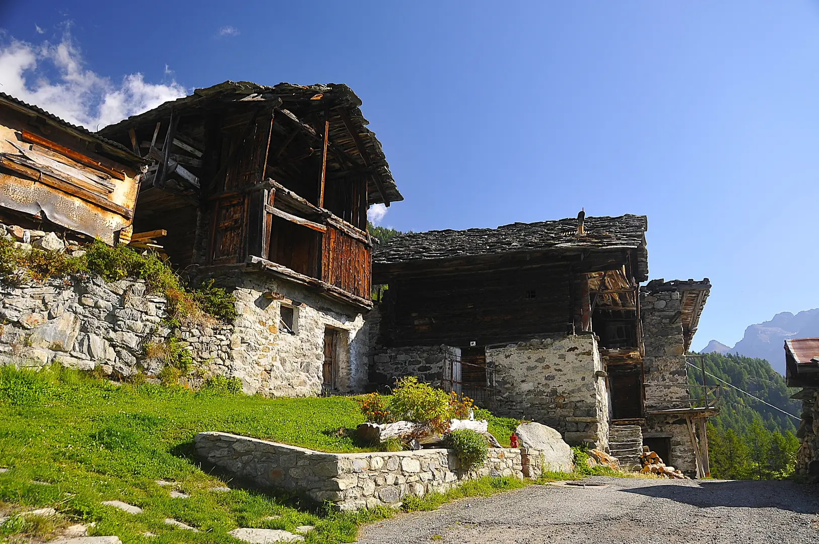
0h00' 0.00km Near a hut with toilets and a drinking fountain 💧, you’ll find a signpost showing the main routes starting from Les Rus. Head straight towards the village and, once you have passed it, descend along the dirt track until you cross the Crête Sèche stream. After a hairpin bend to the left, cross the stream again and head up above the village houses. Leaving the pastures surrounding the village behind, enter the larch forest (Larix decidua), where the road meets the path coming from Lexert.
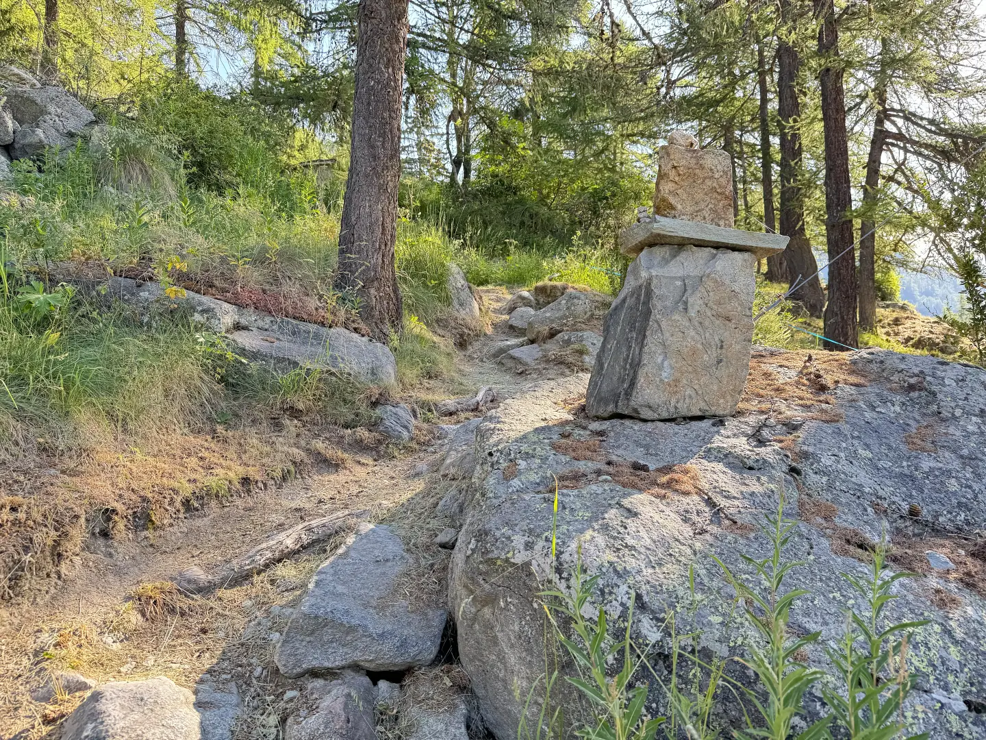
0h10' 0.34km Turn right and follow the path for a short distance, passing a'votive shrine on the left and a stream on the right, before rejoining the farm track. Follow it along a few hairpin bends through the larch forest (Larix decidua), where the trail markers are painted on granite boulders at the edge of the path, until you reach the Berine mountain pasture (1,757m). A little further on, rejoin the path, which crosses the dirt track leading to Berrier three times, with the crossing points marked by yellow discs on the rock; above the path lies a scree slope descending from the wooded hillside. Once you reach the small access road to the Promont mountain pasture (1,857m), turn left and, after about a hundred metres, you’ll reach the junction with the farm track to Berrier and the crossroads (1,870m).
[0h30’T2] 1.10km Ignore the path to Faudery on your left and continue along the road, which is tarmac at first and then becomes a dirt track, with two bends on a moderate gradient in front of the Tour du Fréty (2,489m), whose rock face overlooks the route. The road continues with a long traverse towards the Berrio du Gouvernement ridge, recognisable by the metal avalanche barriers, leaving a small waterfall on the left, fed by the waters of the Crête Sèche stream. Pass two hairpin bends and, at the second one, ignore the shortcut path to the Crête Sèche Mountain Hut. Continue along a gently ascending section of road halfway up the hillside, with views over the slope of Mont Crête Sèche, until you reach the next hairpin bend; take the path that cuts across a section of the farm track, cross the track and rejoin the path which, winding its way through sparse larch trees, leads to the pastures near the Baita della Libertà (2,167m), where a new signpost is located.
1h25' 3.22km Turn left onto the farm track and head north-east until you reach the Berrier mountain pasture (2,193m). Pass the last building, take a path and, after crossing the Vertsan stream, reach the signpost (2,196m).
1h30' 3.46km Turn left and take the path that runs alongside the stream, ascending the small valley, then veer right and gain height via a series of bends that take you round a hillock on the left. The path becomes less steep and crosses a stony pasture dominated by the hillock on which the bivouac is situated, already visible from here. Cross the pasture and join the narrow track that climbs the southern slope of the hillock until you reach the crest. Turn left and continue along an unmarked but easily discernible track towards the cross atop the hill to reach the Gruppo Alpini di Bionaz Bivouac (2,520m).
2h30' 4.96 km (822 m ascent) (0 m descent) Retrace your steps back to the top of the hill and rejoin the path, turning left onto a gentle descent. Cross the Vertsan stream via a wooden footbridge and, a little further on, you’ll come to the ruins of the Chardonney mountain pastures (2,520m). Continue slightly downhill on the right bank of the stream, then leave it behind, following the yellow arrows and cairns through some scree sections at the foot of the rocky slopes of Mont Crête Sèche. Pass a short section of ups and downs to reach the Crête Sèche mountain hut (2,389m).
2h55' 7.01 km (840 m ascent) (156 m descent) From the refuge, descend towards the flags and lose altitude via a series of bends until you reach the junction with the path leading to Berrio del Governo. Turn left and, after a short descent, continue along a long, slightly downhill diagonal path halfway up the slope. When Berrier comes into view, keep to the right at the junction and descend to the farm track you previously followed on the ascent.
3h10' 8.36km Retrace your steps along the farm track and the path, following the same route taken on the ascent, to Les Rus (1,696m) [3h45’T2] 11.59km .
Places of Interest
Collections
Galleria fotografica