Coda Mountain Hut, from Sassa

Edited by:
Massimo Martini
Updated at: 28/08/2026
Access
Leave the motorway [A5] at the Pont-Saint-Martin exit, turn right after 100 metres and, at the first roundabout, take the second exit. Continue to the second roundabout, take the third exit and enter the village of Pont-Saint-Martin. After a few hundred metres, turn right onto the towards the Lys Valley and follow it for 10.20 km, passing through Lillianes and Fontainemore. About one kilometre after Fontainemore, turn right, following the signs for Pian Coumarial, cross the Lys and follow the local road for 7.30 km, passing through Colombit, Pacoulla, Pianpervero, Jugeo, Chouchal, Pra Dou Sas, Cios, Challasc, Colla, Grange, Savaroy, Goy and Coumarial until you reach the large car park at the end of the road. In the adjacent picnic area there is a drinking fountain💧 where you can fill up with water, as there are no other water supply points along the route.
Distance and journey time
🕒 Walking time: 30 minutes
📏 Distance: 18.90 km
GPS navigation
📍 How to get there with Google Maps
📍 How to get there with Apple Maps
ℹ️ Important note
The directions provided were verified on the date the route was mapped. Before setting off, it is advisable to check for any changes to the route. For up-to-date and detailed directions, we recommend using Google Maps or Apple Maps.
Introduction
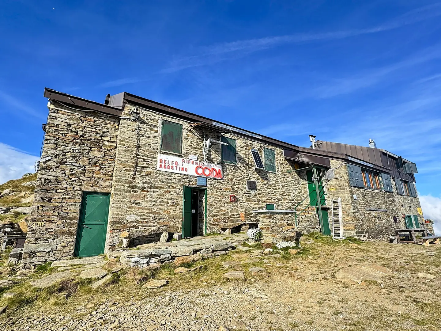
A route that climbs up the valley between Sassa and Colle di Carisé, passing through high-altitude pastures, mountain pastures and sparse larch woods, up to the grassy ridge where the Coda Mountain Hut is situated. The entire route coincides with the Tor des Géants trail, which, following the Alta Via 1, briefly crosses into Piedmont on this very stretch, passing the Coda Mountain Hut before continuing towards the Passo della Sella. The route passes through the Plan des Sorcières, a plateau where several flat rocks at the edge of the meadow bear cup marks of various sizes and of great antiquity: according to popular legend, this was the place where witches (sourcières) gathered for their sabbath, and it is to this tradition that the plateau owes its name. Once past Colle Portola, with views of the silhouette of Mont Mars, the path continues halfway up the hillside until it meets the route coming from Fontainemore and climbs up to Colle di Carisé, the crossroads between the Gran Traversata delle Alpi and the Alta Via Alpi Biellesi; from here, already in Piedmontese territory, the final stretch follows the grassy ridge, with a short rocky section, up to the mountain hut.
The recommended period is from summer to early autumn.
A T2-rated route, with moderate but continuous elevation gain and distance; no exposed sections are reported in the route description.
Description
0h00' 0.00km Take the path near the signposts and start climbing up through the pasture, quickly reaching the hamlet of Sassa (1,433m). Continue past the mountain pasture on a diagonal ascent, through patches of larch (Larix decidua), crossing the farm track a couple of times, then follow the path up through the pastures until you cross the farm track near La-Praz-de-Bosc (1,736m).
1h00' 1.47m From the end of the farm track, continue across the pasture heading towards theVallessa mountain pasture (1,894 m), to reach, a little further on, Pian di Sourciéré, a plateau situated at 1,954 m characterised by the presence of several flat rocks at the edge of the meadow, on which cup marks of various sizes and of very ancient origin are engraved; according to popular legend, the plateau was a gathering place for witches (sourcières) for their sabbaths. Pass the plateau and, amongst the junipers (Juniperus communis), reach Colle Portola (1,966 m), a broad saddle from which the compact silhouette of Mont Mars appears on the horizon. Continue down a short descent, then follow the hillside halfway up the slope until you meet the path coming from Fontainemore.
1h45' 3.19 km (627 m ascent) (6 m descent) After a few tricky sections amongst the boulders, you reach the grassy saddle of the Col de Carisé (2,124 m), where there is a rectangular stone marker with signposts fixed to it.
1h55' 3.51 km (698 m elevation gain) (6 m elevation loss) Turn left and follow the grassy ridge uphill. Climb over a first hump, then proceed along a gully with a short step. Resume the ascent, climbing over a second grassy hump until you can see your final destination. Continue on a gentler slope until you reach the Coda Mountain Hut (2,280m). 2h30' 4.43km
The return journey follows the same route taken on the ascent. [1h20’T2] 4.43 km (13 m elevation gain) (846 m elevation loss)
Comments (0)
Sign in to leave a comment