Gastaldi Mountain Hut, from the Giasset car park

Edited by:
Massimo Martini
Updated at: 03/09/2026
Access
Road directions
From the motorway toll booth [A5] towards Turin North (Settimo Torinese toll gate), a toll section, join the [A55] ring road heading south-west for 6.1 km (6.1 km in total). Take the Borgaro exit towards Turin/Venaria Reale Nord/Reggia and Giardini for 300 metres (6.4 km in total). Continue on the towards the Royal Palace for 2.4 km (8.8 km in total), keeping to the left at the next junction for a further 1.1 km (9.9 km in total). At the roundabout, take the second exit, staying on the for 1.0 km (10.9 km in total), then at the next roundabout, take the first exit, joining the towards the Lanzo Valleys for 8.6 km (19.5 km in total). At the next roundabout, take the second exit, staying on the for 10.6 km (30.1 km in total). Continue straight ahead on the for 140 metres (30.2 km in total): the road curves slightly to the right and rejoins the of the Valli di Lanzo for a further 600 metres (30.8 km in total). At the next roundabout, take the second exit, staying on the for 10.2 km (41.0 km in total), then turn left, staying on the same road for 15.5 km (56.5 km in total). Continue along Via Capoluogo, in Balme, for 5.8 km (62.3 km in total): the car park is on the left.
Car park
In Pian della Mussa, in the municipality of Balme, you’ll find the free Giasset 🅿️ car park along Via Capoluogo. This is the starting point of the route.
Access by public transport
To reach the starting point of the route, you will need a private vehicle, as the area is not served by public transport.
Distance and journey time
🕒 journey time: 1h 16’
📏 distance: 62.3 km
GPS navigation
Important information
The directions provided were verified at the time the route was mapped. Before setting off, we recommend checking for any changes to the route or road conditions. For up-to-date information, please consult Google Maps or Apple Maps.
Introduction
From the head of the Val d’Ala, enclosed by the Ciamarella and Bessanese ridges, the path to the Gastaldi Mountain Hut climbs from Pian della Mussa up to the glacial cirque of Crot del Ciaussine, which takes its name from an ancient lime quarry. The route crosses the Stura di Ala at theAlpe Rocca Venoni, climbs with numerous hairpin bends along the Canale delle Capre, passes through the grassy plateau of Pian dei Morti and cuts across the slopes of Rocca Turo before the final, gently sloping stretch leading to the refuge.
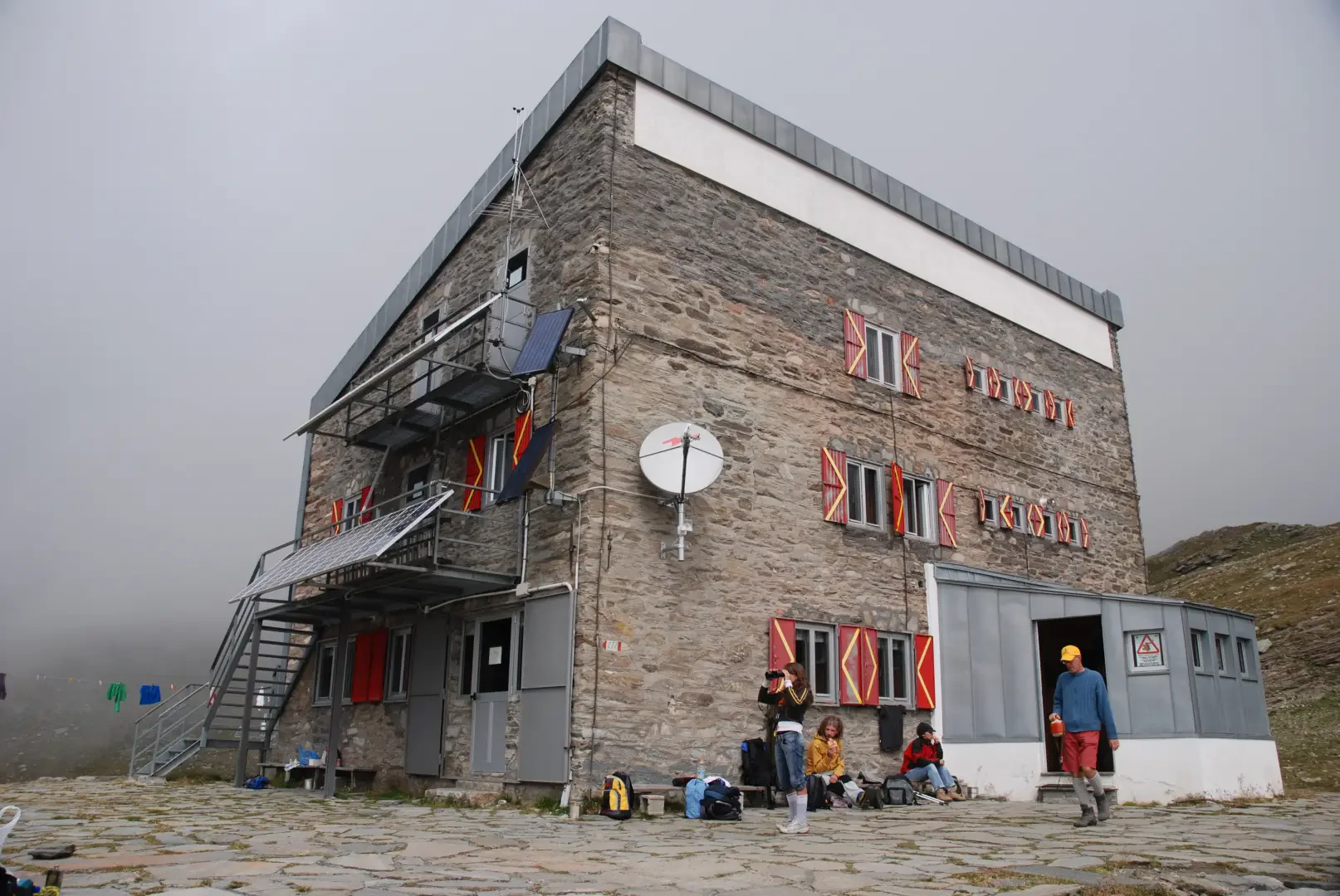
The Gastaldi, the oldest mountain refuge in the Lanzo Valleys, occupies a panoramic position overlooking the glacial basin with views of the peaks of the range — Ciamarella, Albaron di Savoia, Punta Maria, Cima d’Arnas and Bessanese itself — and is the starting point for the ascent of both the main peaks in the area.
The best time to visit is from summer to early autumn, subject to the opening of the Pian della Mussa road and the presence of residual snowfields at higher altitudes. The path is signposted and suitable for hiking; it features a few short rocky steps and a traverse equipped with handrails in the upper part of the Canale delle Capre, which should be tackled with care in the event of wet rock or residual snow.
The path features short rocky sections equipped with handrails. Snowfields may persist at the start of the season; check the conditions and whether the Pian della Mussa road is open before setting off.
Description
0h00' 0.00 km From the Giasset car park, situated at the bottom of Pian della Mussa, take the track leading towards the Città di Cirié mountain hut until you reach a fork in the track.
0h02' 0.07km Turn left before the slope steepens and cross the Stura di Ala via the wooden footbridge, heading towards theAlpe Rocca Venoni, recognisable by the large boulder overlooking the buildings. Without reaching the mountain pasture, turn right and follow the path alongside the stream.Cross a few tributaries and begin the ascent along the Canale delle Capre on rocky ground; take care when the ground is damp. Follow the numerous hairpin bends until you have passed the steepest section of the gully. Continue along the ascending traverse, where some short sections are equipped with handrails, until you reach Pian dei Morti, a grassy plateau at an altitude of around 2,200m.
1h00' 1.68 km (354 m ascent) (5 m descent) At the erratic boulder, ignore the path on the right heading towards Pian del Gias and continue left on . Pass through the Naressa pastures and climb first diagonally, then in wide switchbacks over some equipped rocky steps, cutting across the slopes of Rocca Turo to ascend the next small valley. Reach the pass from which the refuge comes into view and continue along a gentle slope in the glacial cirque of the Crot del Ciaussine’ until you reach the Gastaldi Refuge (2,659m) [2h30’T2] 4.12 km (875 m ascent) (5 m descent).
The return journey follows the same route taken on the ascent [1h15’T2] 4.13 km (5 m elevation gain) (875 m elevation loss).
Places of interest
Pian della Mussa
Alpe Rocca Venoni
Pian dei Morti
Rifugio Gastaldi
Balme
Comments (0)
Sign in to leave a comment