Col Lazouney, from Steina


Edited by:
Massimo Martini
Updated at: 02/11/2025
Access
Leaving the motorway at Pont-Saint-Martin, after 100m turn right, pass a first roundabout, the second exit, and at the second turn left, the third exit, entering the town of Pont-Saint-Martin. After a few hundred metres you come to the start of the road to Valle del Lys, turn right and follow it for about 23km, passing the villages of Lillianes, Fontainemore, Issime and Gaby. When you reach the village of Steina, there is a car park on the left: here you can leave your car without restriction and set off on your hike.
Introduction
The Loo valley is a pleasant expanse of pastureland along the orographic left of the Lys valley. Punctuated by interesting alpine pastures, often recovered from the ravages of time, the valley is traversed almost its entire length by the Aosta Valley's Alta Via 1. The proposed route is to be considered as an exhaustive introduction to this area rich in history and scenic highlights. It can be combined with other destinations such as the Punta Lazouney, the Col de Loo or the Passo del Maccagno, but one must take into account the discrete kilometre development that makes it necessary to have a decent pace.
This section of the Alta Via is covered annually by the endurance trails (4KVDA and Tor des Géants) and a warm refreshment stop can be found at Obre Bodma. For those who want to follow the athletes on their demanding route, this hike certainly offers many insights.
Description
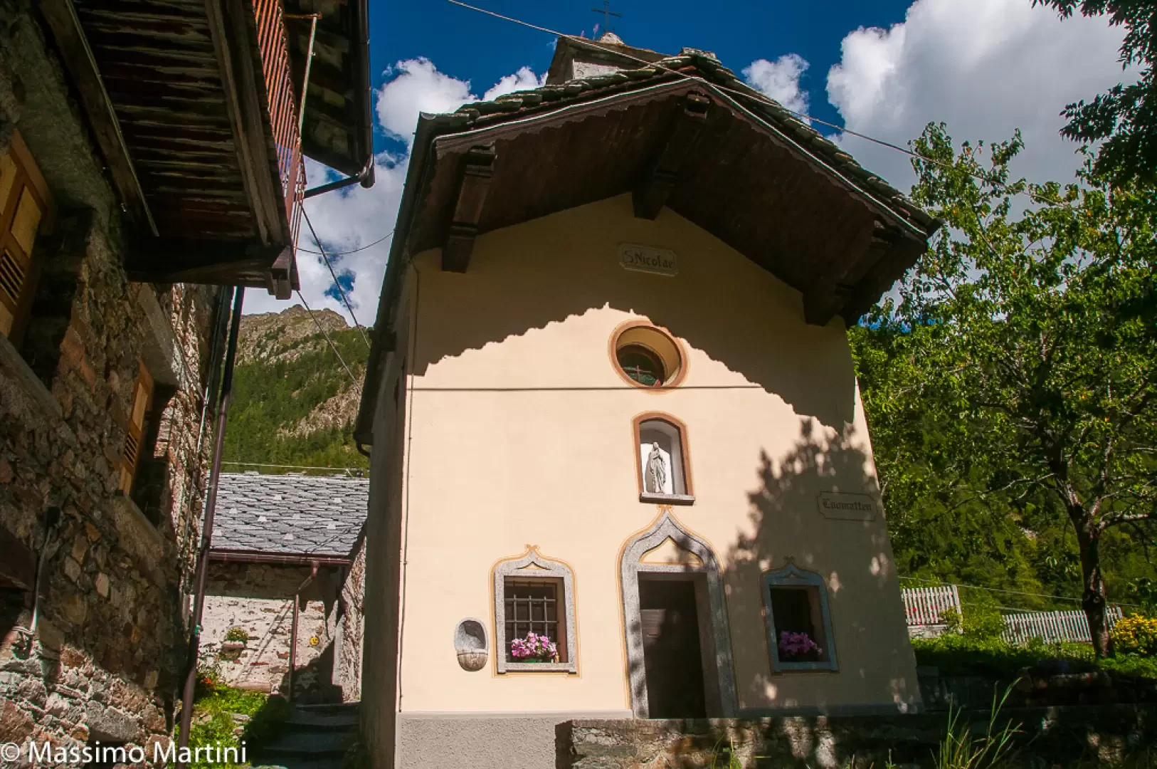
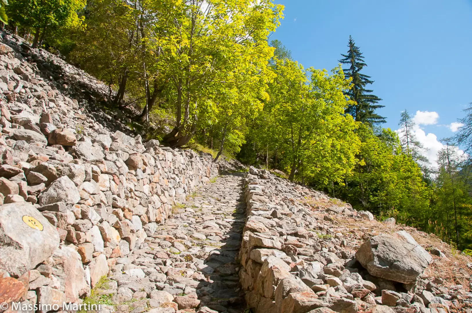
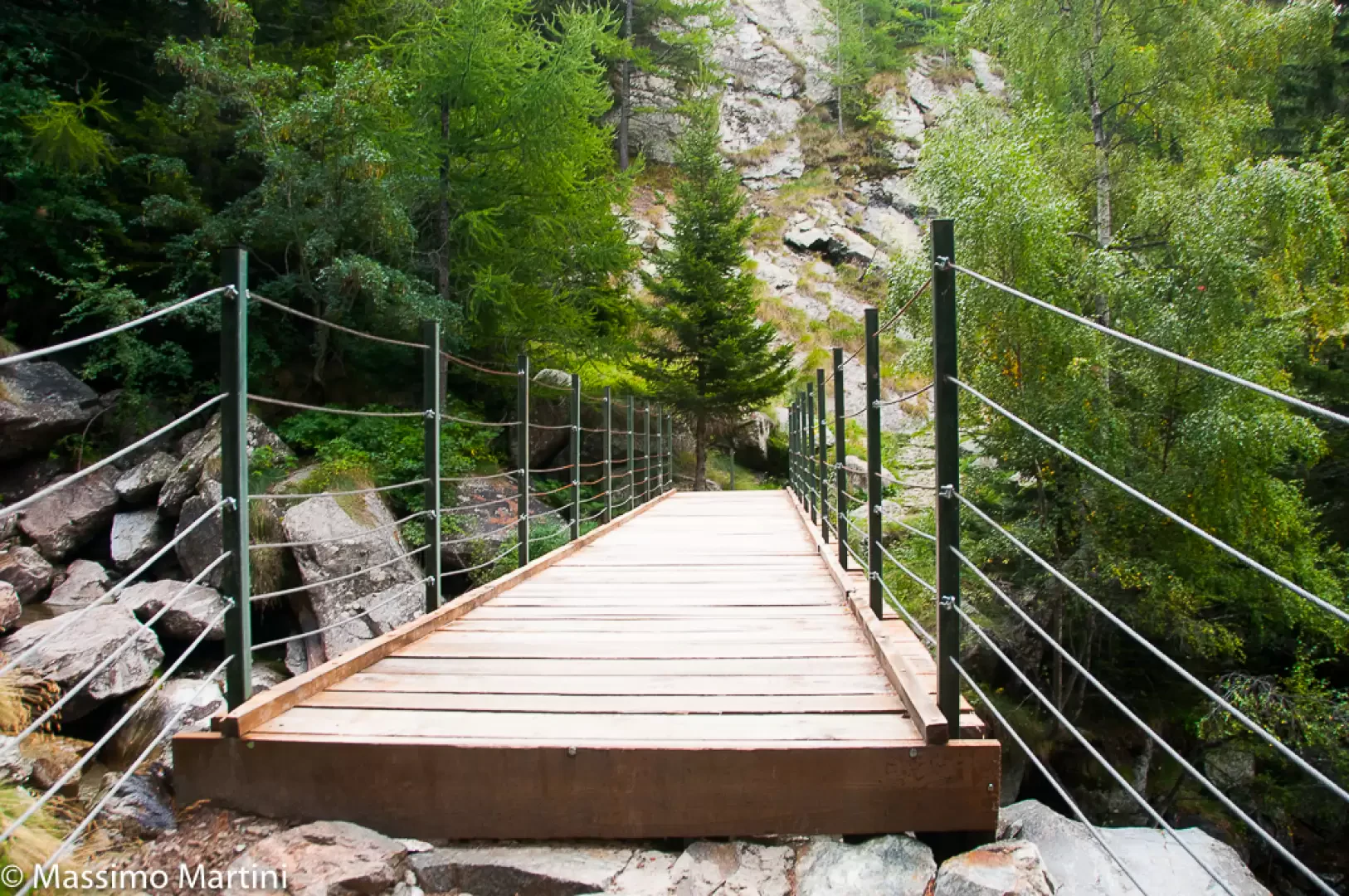
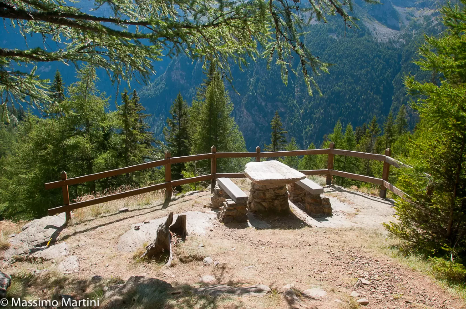
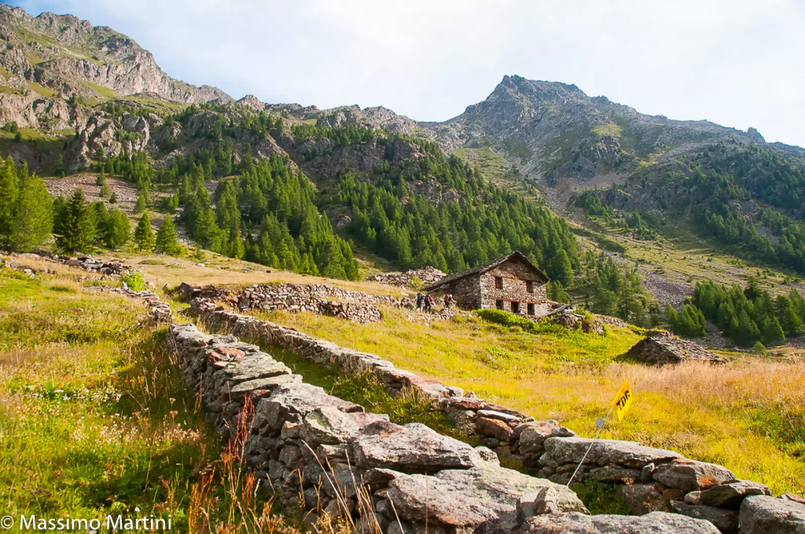
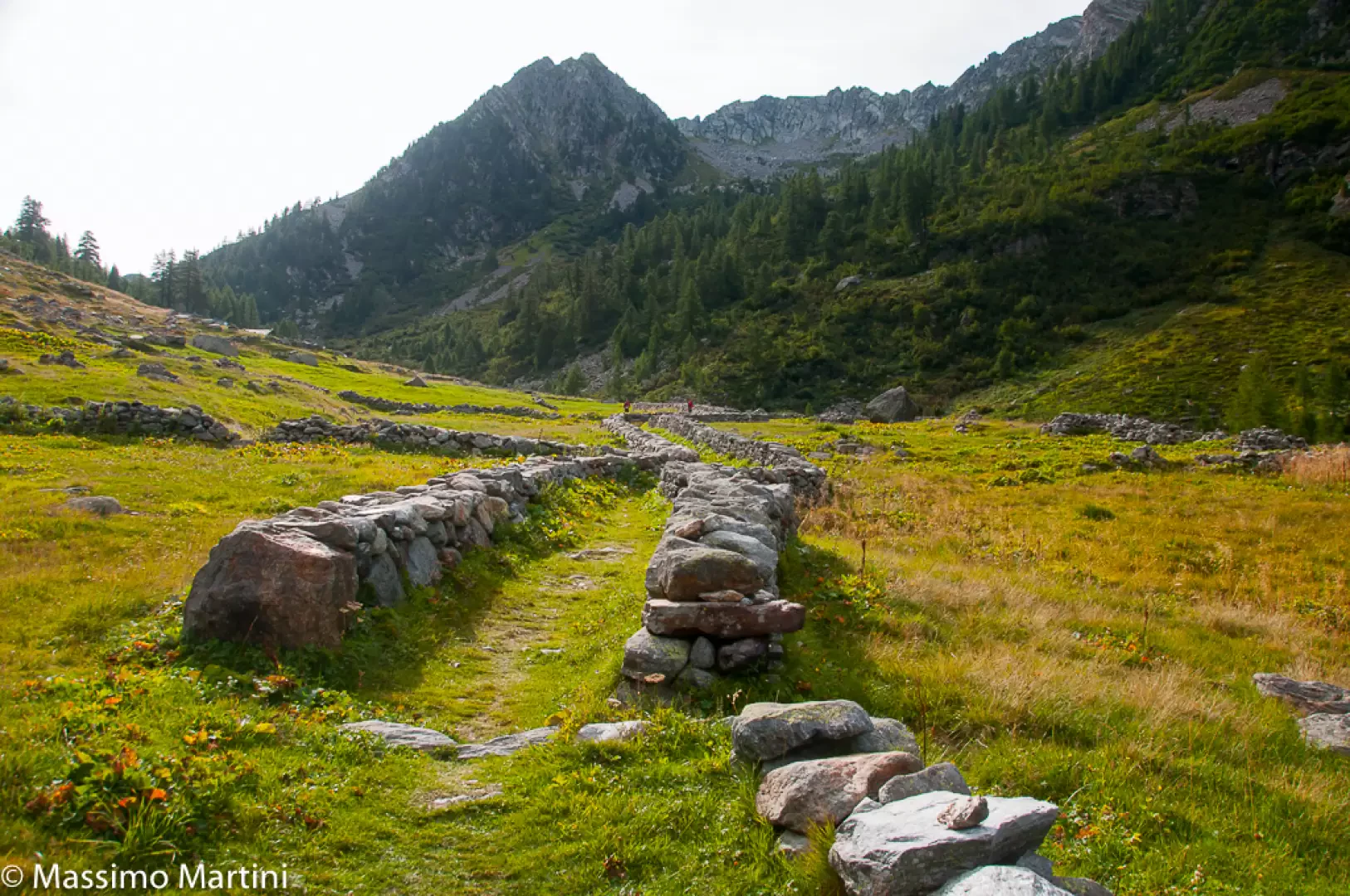
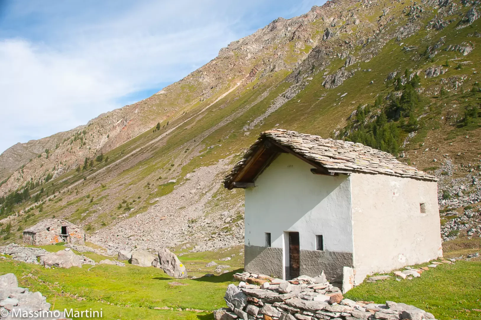
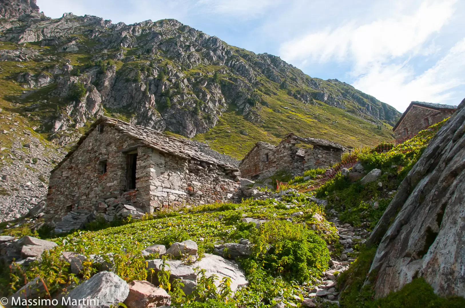
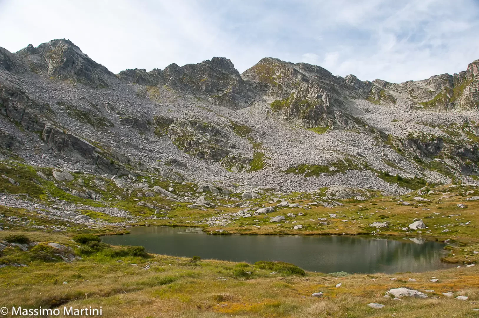
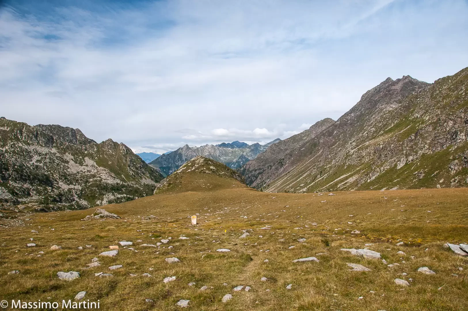
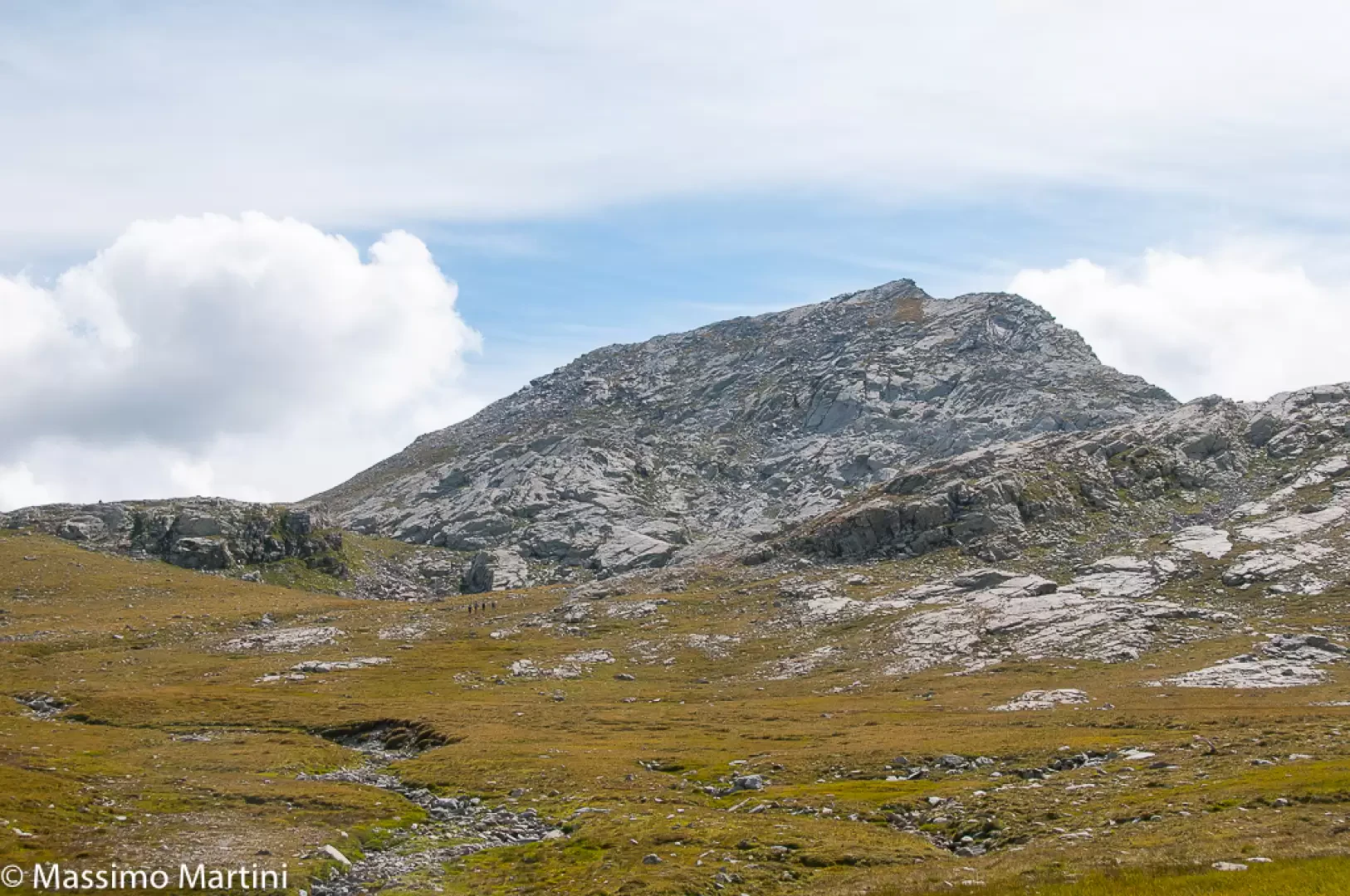
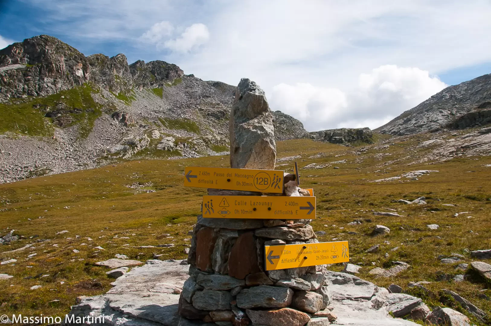
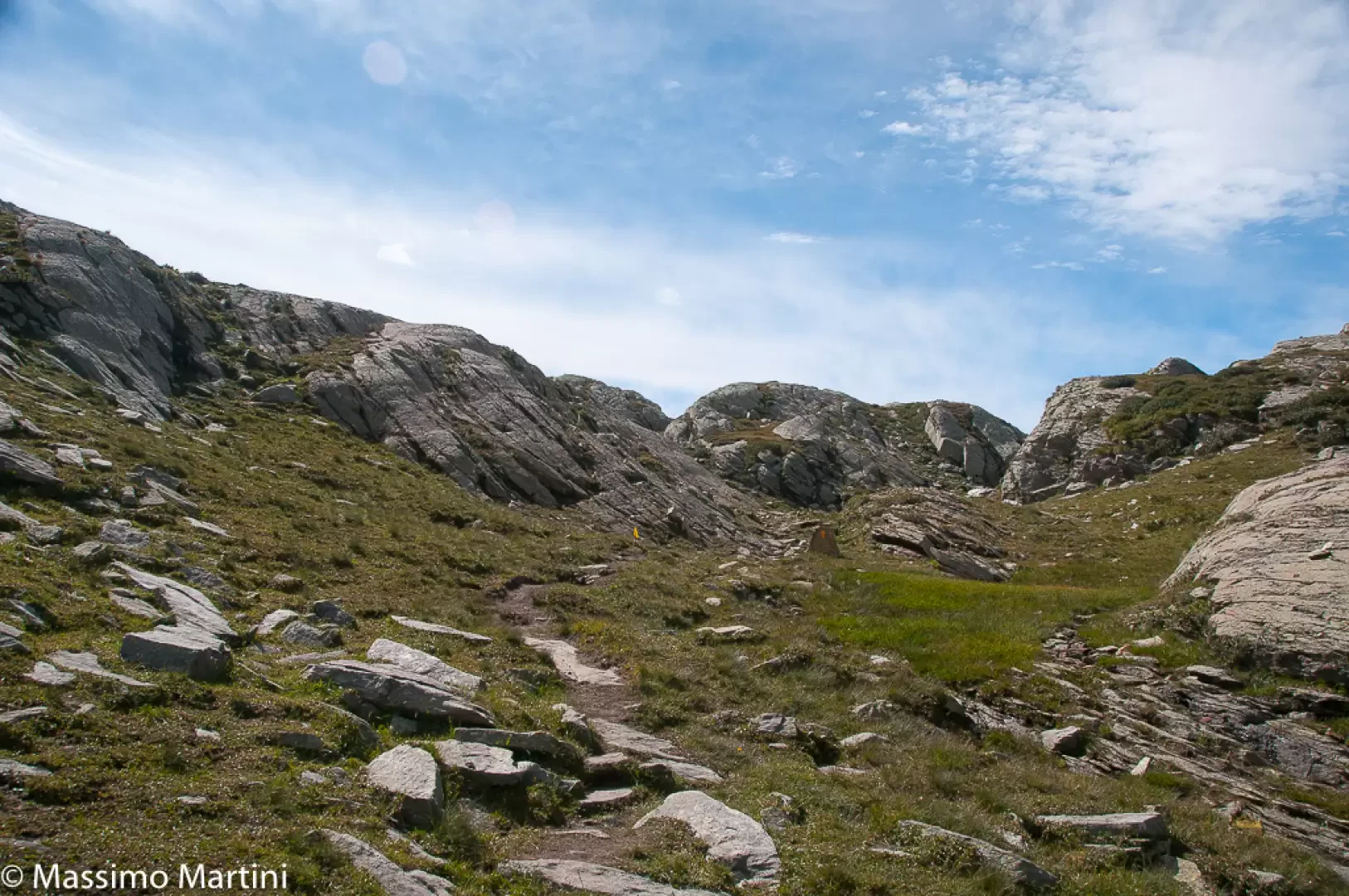
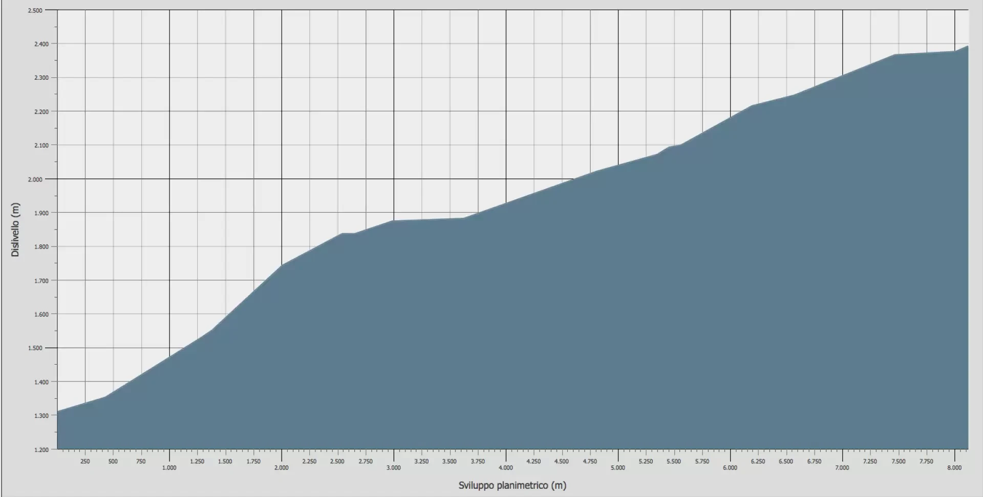
Leave your car in the car park on the left-hand side of SR44 and cross the road, walking between the houses of Steina. At the first bollards, follow the signs for Col Lazouney, given a 4h00' walk. Proceed along the asphalted road, which after a turn to the right climbs fairly steeply until reaching the hamlet of Loomattò, where there is a pretty chapel dedicated to St Nicholas. Climb the gentle steps that flank the chapel before turning right and passing the last characteristic houses of the village and a fresh water fountain. The pavement becomes grassy, indicating the start of the path, which, after a left turn, enters the forest. Some sections of the mule track are of exquisite workmanship, with the stone paving laid with the proverbial Walser attention to detail (for them, these were the main communication routes). The ascent proceeds with a regular gradient, alternating between stepped stretches and smoother ones, always heading south towards the entrance to the valley. Some wooden railings precede the crossing of the Lòbach, the valley's main stream, effectively decreeing the entrance to the long valley. The path makes a few turns with a fair gradient, allowing you to immediately gain altitude over the Lys valley below. The twists and turns follow one another and the forest is interspersed with huge stony landslides. One passes a table with wooden benches placed in a panoramic position over the valley below, and in particular over the long ridge that goes from the Weiss Weib to Mont Nery, and slowly the path abandons its sinuous course to become more linear, following the interceding orographic relief. You pass the last of the steep slopes and finally reach the entrance to the valley proper as the houses of Onder Lòò appear on the horizon. A wooden footbridge takes us to the orographic right of the valley and we peremptorily go back in time, when the roughness of the alp was mitigated by the arduous work of the valley dwellers. Evidence abounds and the retaining walls that accompany the path are worthy examples of this. Crossing the hamlets of Onder Lòò (1863m), the slope moderates a little, allowing us to recover energy and breath in view of the still long walk. In sequence, we skirt the hamlets of Ondrò Bodma (1884m) and Obrò Bodma (1910m) and, without any particular difficulty, reach the last of the inhabited hamlets, Ober Lòò (2090m), anticipated by the pleasant chapel of San Lorenzo. Taking care to follow the markers well, which disappear a little in the vicinity of the alpine pastures, we now proceed with a more accentuated ascent, crossing the middle part of the valley characterised by wide pastures that develop at the edges of small rocky outcrops. The path becomes evident again and goes round the Pioane ridge to reach the foot of the hillock known as Monte Kick (2315m), which is easily bypassed to the right. We now proceed along a level stretch where the traces of a buried lake are evident on the left, while on the right, with a short diversions for those who wish, we can reach the pleasant little lakes of Seebna (2221m), also known as delle Piane. The trail begins to climb again on the pleasant grassy pastureland between the two rocky ridges that separate the Niel slope to the south with Mont de Pianeritz (2550m) and Lazoneyhòre (2501m) and to the north with Val Vogna via the long ridge that descends from Corno Rosso to Passo del Maccagno (2493m). The ascent slopes down in the final section of the valley, which opens up with a wide amphitheatre in the presence of the Punta di Lazouney, Col del Lò and Monte Cossarello. The path tends to the right and leads to a wetland area that precedes a boundary stone with signposts (2364m): here, leave path 12, which leads to Col del Lòò, and continue to the right following the signs for Col Lazouney (2392m), which is reached after about 10 minutes' walk.
The return is along the same route as the outward journey (2h 30'). For those wishing to make a traverse, you can either descend along path no. 6 to Niel (where there is a stage post - La Gruba) with about 1h30' walk, or you can continue on to the Rivetti refuge with 1h15' walk.
General information
Tour: from Steina along the route of the Alta Via 1 della Valle d'Aosta
Trail signposts: 12, 12C, AV1
Type of route: a/r
Recommended period: June, July, August, September
Exposure to the sun: west
Objective Danger: none
Exposed Tracts: none
Useful Equipment: normal hiking equipment
Water: Loomattò
Riferimenti Bibliografici
- Alte Vie della Valle d'Aosta - Martini Massimo e Zavatta Luca -
Galleria fotografica