Marmot Refuge, from Bruil


Edited by:
Massimo Martini
Updated at: 20/10/2025
Access
Leave the motorway at the Aosta Ovest exit and continue to the junction with the main road. Turn left at the traffic lights and proceed in the direction of Courmayeur. Pass the villages of Saint-Pierre and Villeneuve, then, after 6.6 kilometres, take the regional road of Valsavarenche on the right, which quickly crosses Introd and, after a further 4.7 kilometres, branches off to become the regional road of Valle di Rhêmes. Drive up the valley for 14.9 kilometres, passing Rhêmes-Saint-Georges, until you reach Bruil, capital of the municipality of Rhêmes-Notre-Dame. Here you can park your car in the car park (🅿️) in front of the town hall or, in case of heavy traffic, in the car park (🅿️) located on the right, just before entering the village.
Distance and travel time
🕒Travel time: 33 minutes
📏 Distance: 26.2 km
GPS navigation
📍 How to get there with Google Maps
📍 How to get there with Apple Maps
ℹ️ Important note
The directions given were verified on the date of the route survey. Before departure, it is advisable to check for any changes to the route. For up-to-date and detailed directions, we recommend the use of Google Maps or Apple Maps.
Introduction
Description
0h00' -
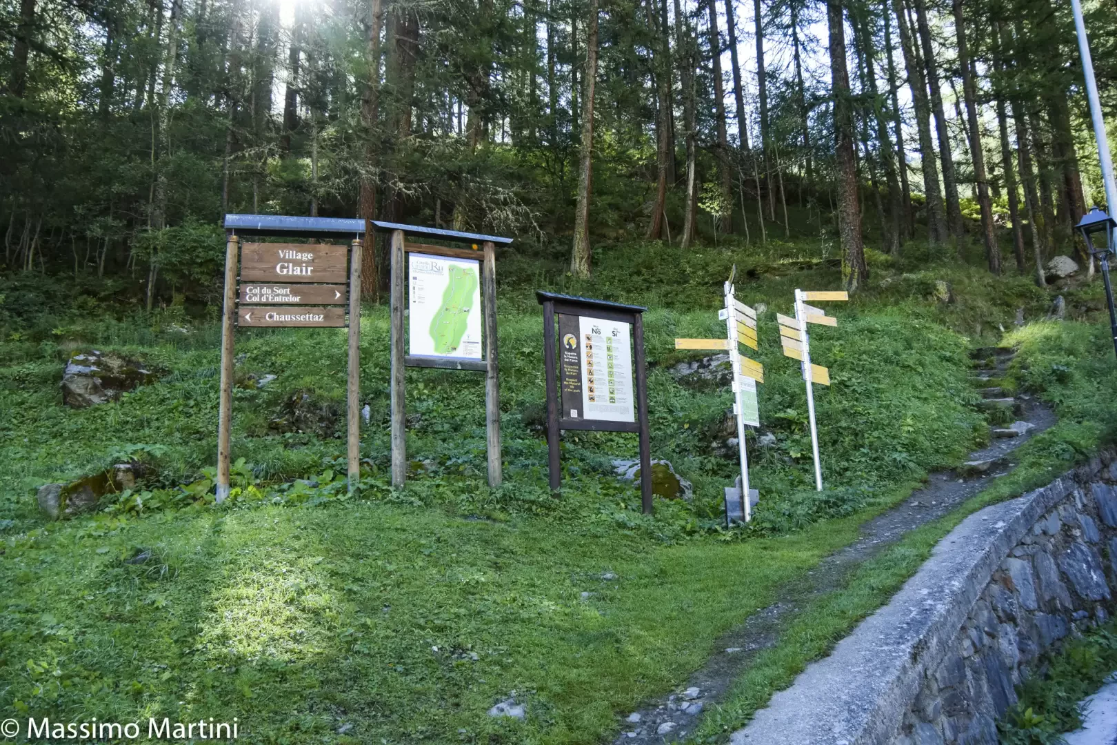
After leaving your car in the little square in front of the town hall, you will immediately come across the signposts indicating the main routes departing from Bruil. Follow the signs for the Alta Via and the path
as you proceed towards the town hall, then turn right onto a small road that crosses the hamlet, fountain 💧. Pass through the village with its characteristic hamlets and, after a second fountain 💧, cross the Dora di Rhêmes stream right in front of the Gran Paradiso National Park ranger's hut in the hamlet of Glair.
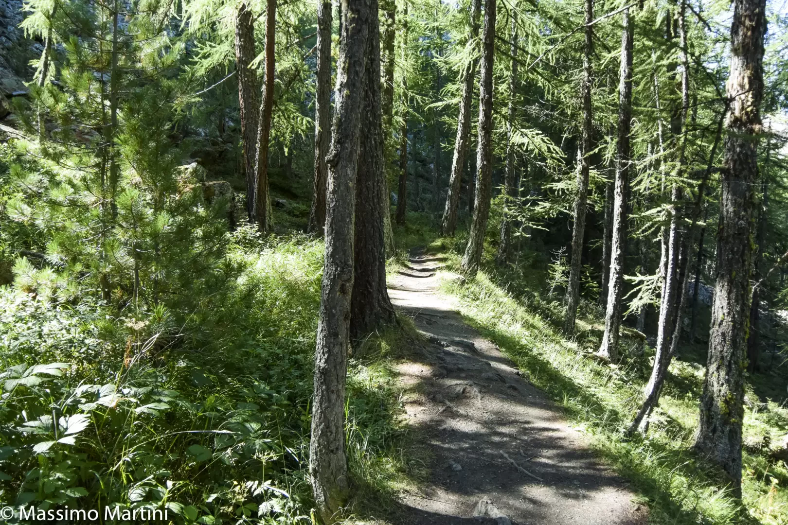
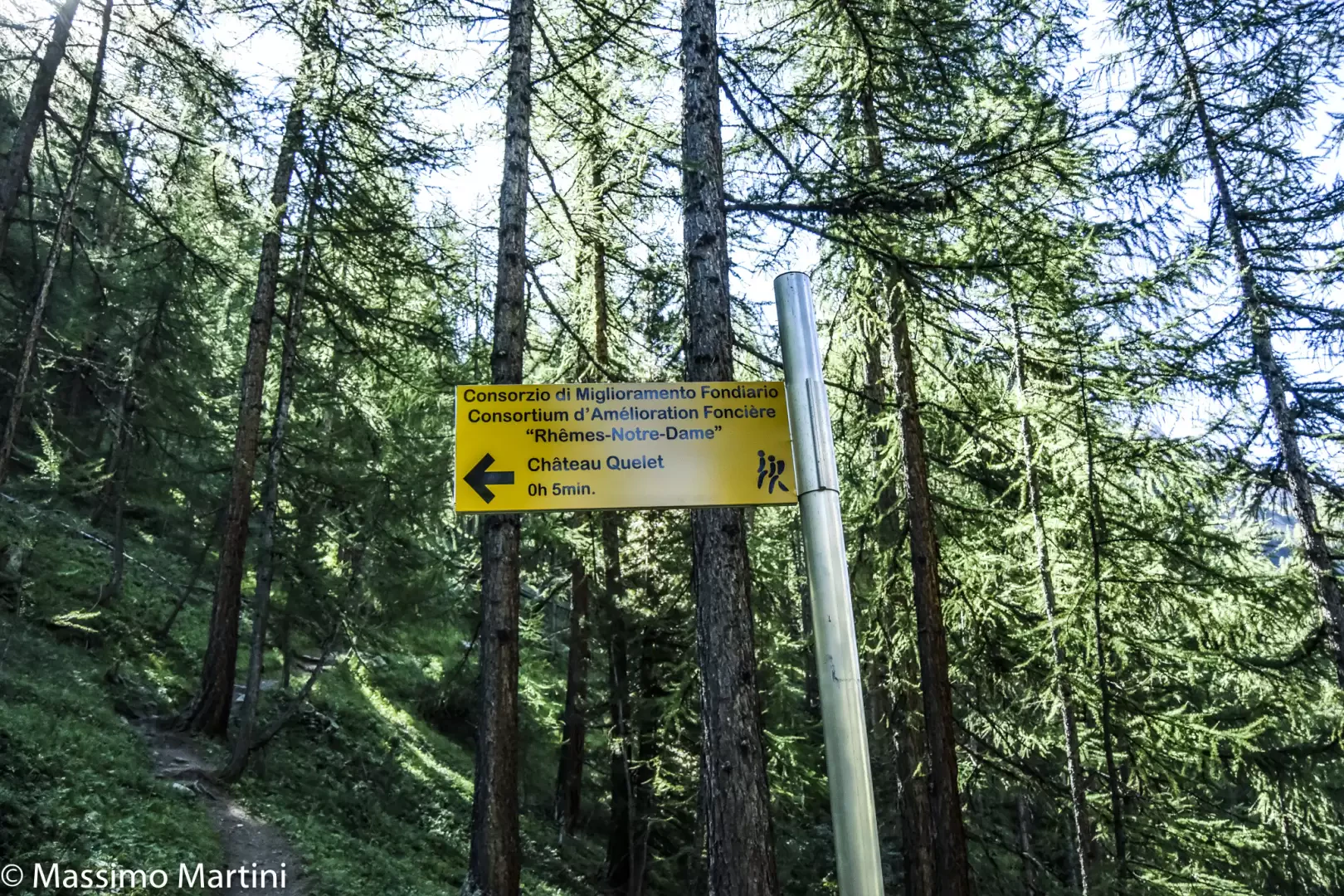
0h05' In front of the hut, you will again come across signposts directing hikers to the paths on the orographic right-hand side of the valley. Take the wide path that begins to climb the slope between imposing larches. After a hundred or so metres, you come to the farm road to the Pré de Bois alpine meadow, which you follow for a short distance before rejoining the path. Climb up the slope at the edge of the forest, making a wide bend to the right until reaching the Pré de Bois pasture (1787m).
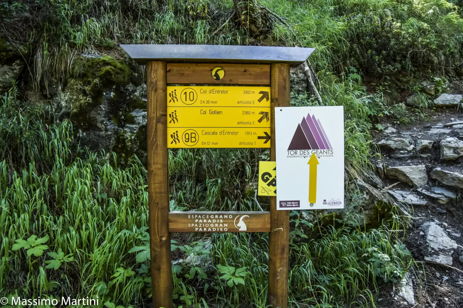
0h10' The path enters the larch forest, with a series of short bends quickly gaining height until reaching the crossroads for the Vallon de Sort, which should be left behind.
0h20' Follow the path to the right, skirting the calm waters of the ru, passing under the rocky spur of the Château Quelet, until you come to an obvious signpost indicating that you should resume the ascent.
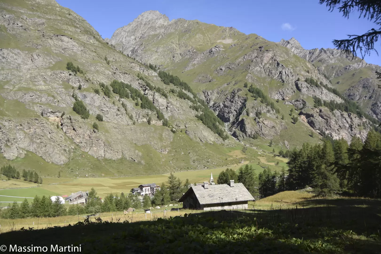
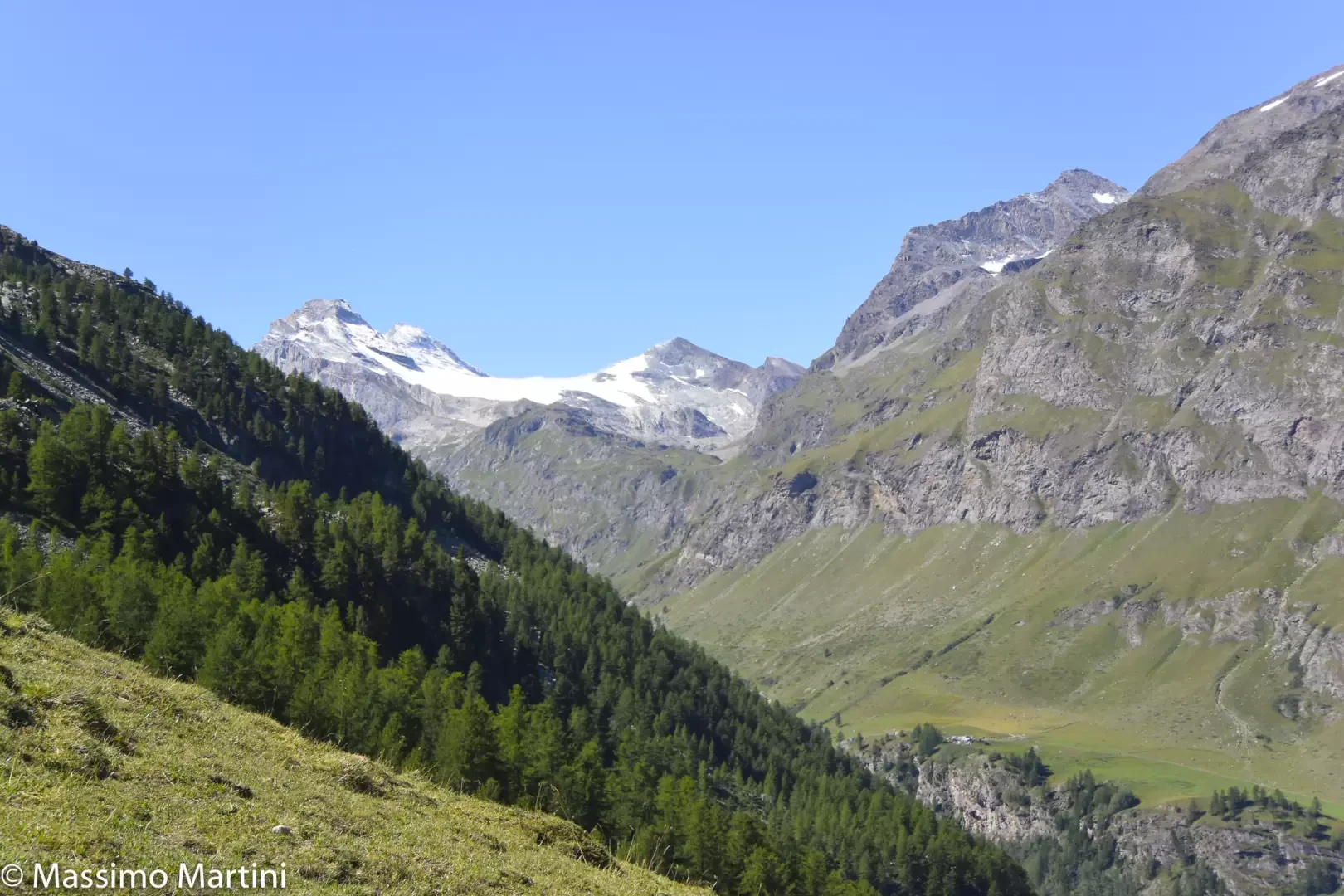
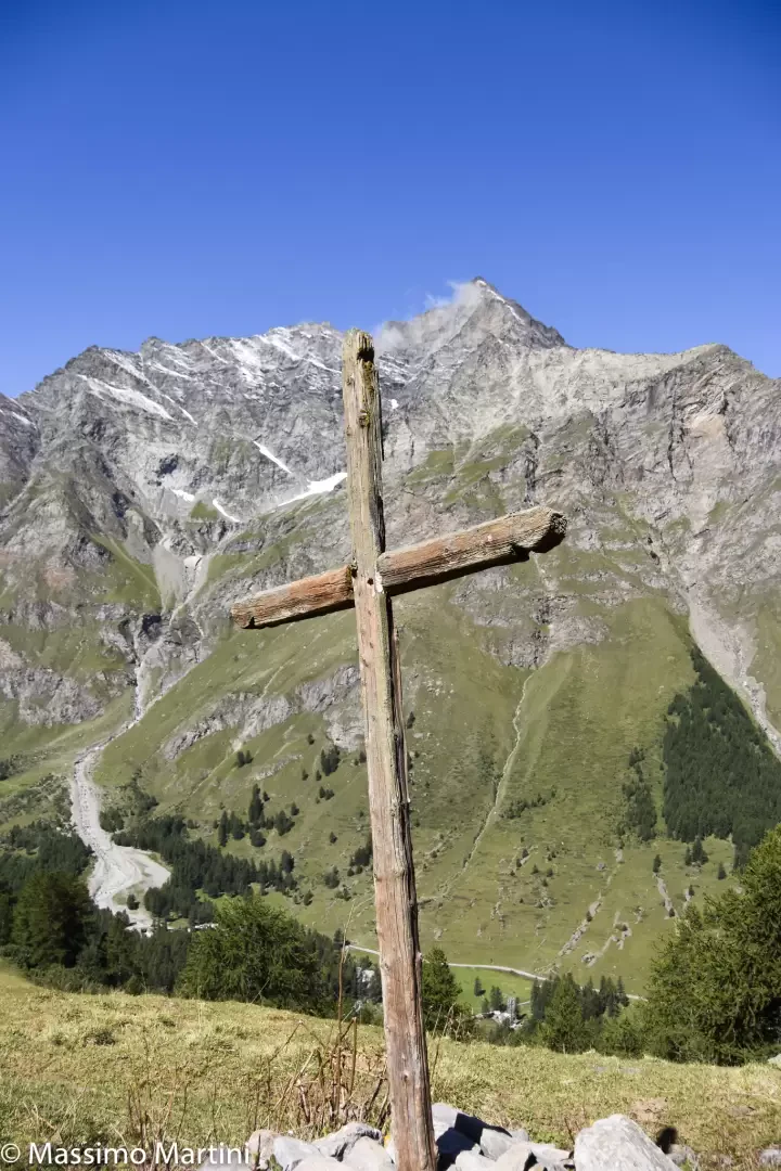
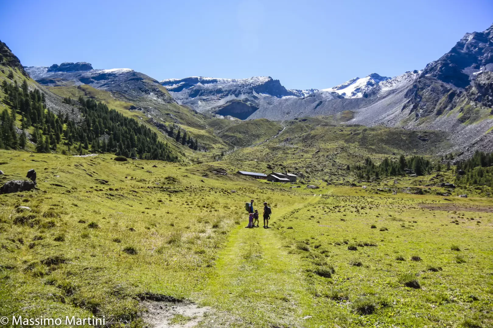
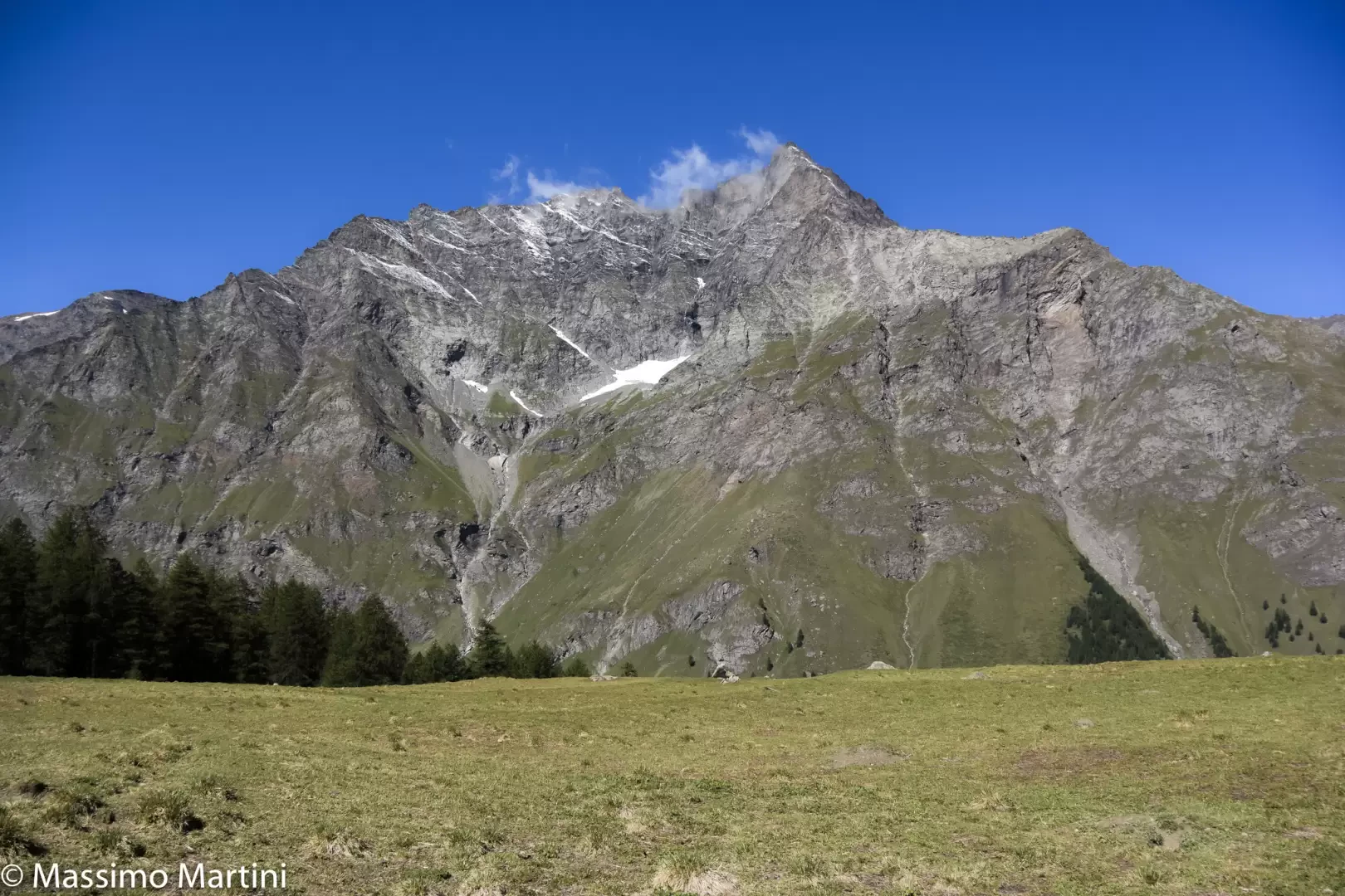
0h50' Climb the slope at first with greater intensity and then with a series of bends, quickly overcoming the section of the hike with the greatest difference in altitude before coming out of the wood into the beautiful clearing of the Comba di Entrelor. You come to a wooden cross (2104m), an excellent "lookout" over the middle-high Val di Rhêmes, from which there is a fine view of the peaks that divide the watershed with the Valgrisenche, from Granta Parei to Becca Laugier and, above all, you begin to appreciate the harsh environment of the Entrelor valley, catching sight of the pass of the same name in the distance.
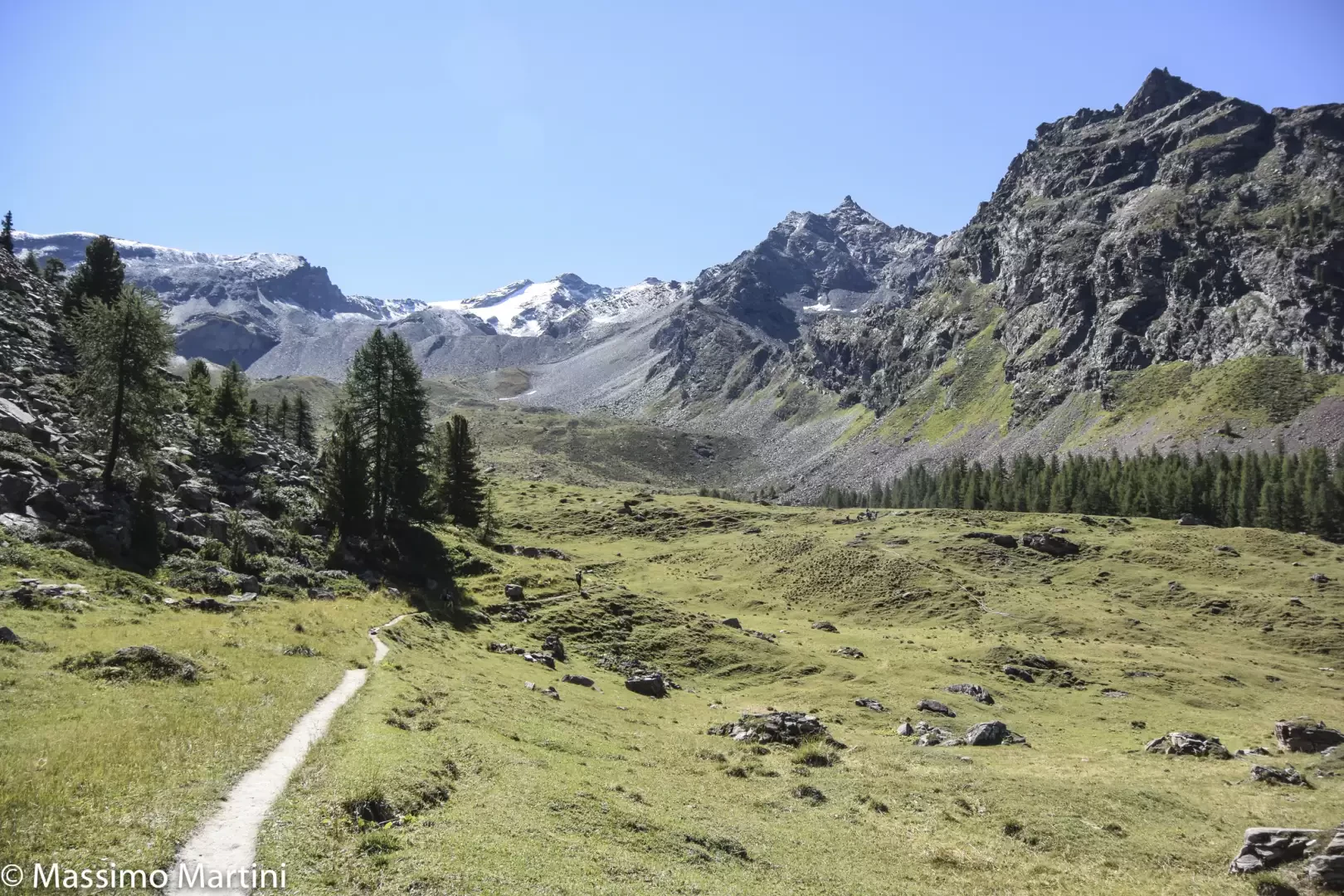
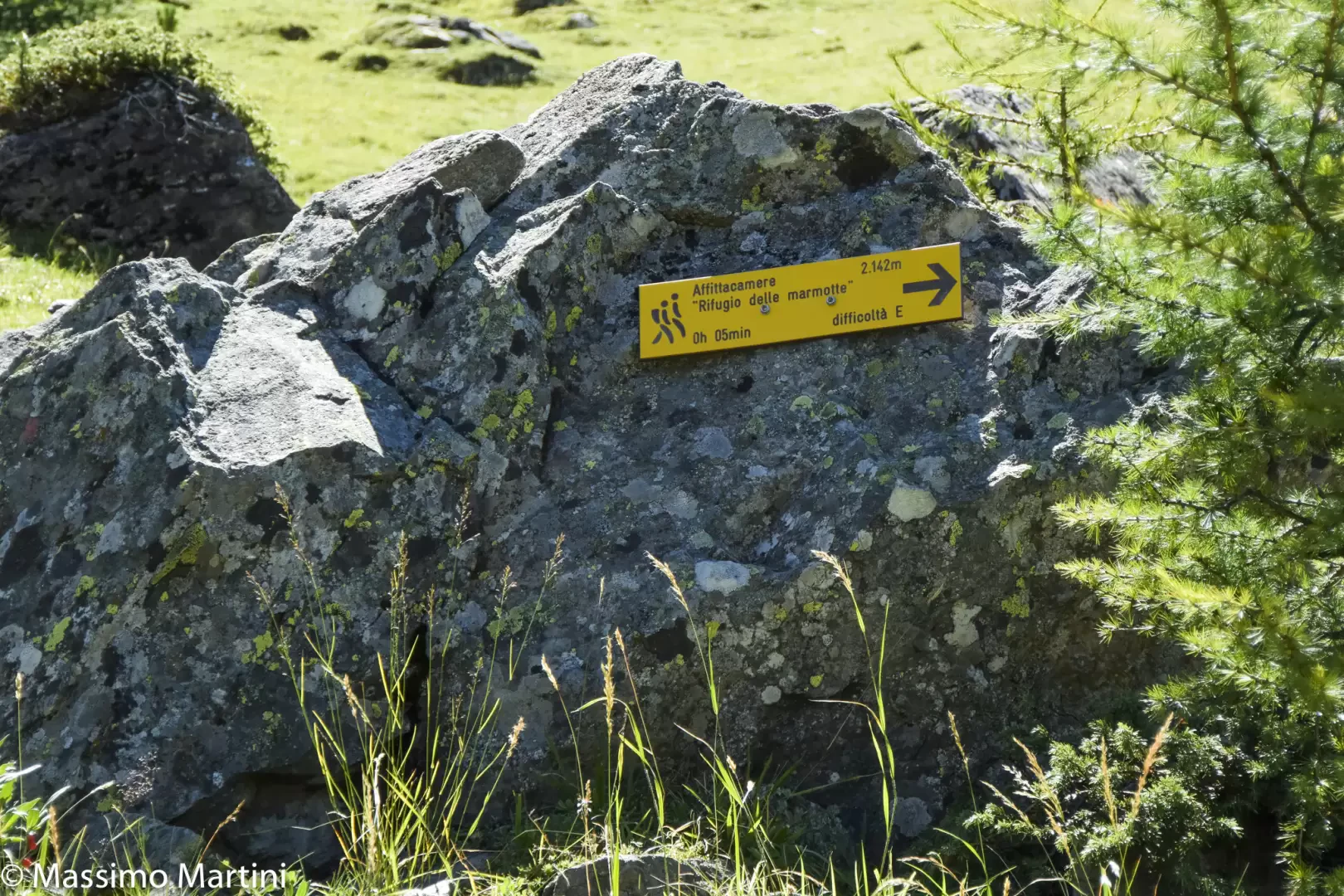
0h55' Continue now under the open sky among the pleasant pastures of the basin, following the obvious path that sinuously traces out pleasant curves. At the height of an erratic boulder, you will come across a post indicating the hut 5 minutes away. Follow the path to the right and you will soon reach the cluster of hamlets that make up the village of Entrelor 💧, the largest of which is the Refuge des Marmots (2142m, 1h05').
The descent follows the same route as the ascent (0h35'.
Galleria fotografica