Tête de Barasson, from Eternod-Dessus

Edited by:
Massimo Martini
Updated at: 11/08/2026
Access
Road directions
Leave themotorway [A5] at the Aosta Est toll station (toll section) and continue on the A5-SS27/E27 link road for 350m (0.35km).
🚧 The tunnel section of the link road between the motorway toll plaza and Signayes is closed to traffic until June 2027. The route described here avoids this, taking you along the and Viale del Gran San Bernardo until you rejoin the .
Take the exit onto the state road through the Aosta ValleyAosta towards Aosta Centro/Monte Bianco for 100m (0.45km). At the roundabout, take the second exit and continue on the for 2.6km (3.05km). At the next roundabout, take the first exit and follow Viale del Gran San Bernardo for 3.3 km (6.35 km), then join the for 3.5 km (9.85 km). Continue along the for 13.7 km (23.55 km), passing through Gignod and Etroubles, until you reach the junction for Eternod-dessus. Turn slightly right onto Rue du Grand-Saint-Bernard for 88 metres (23.64 km), then turn sharply right and continue along the same road for 700 metres (24.34 km). Turn right and drive for 3.4 km (27.74 km), keep to the right for 300 m (28.04 km), then turn left and continue for 1.3 km (29.34 km). Turn left and take the road to Eternod dessus, travelling the final 150m (29.49km) to your destination, on the right.
Car park
In the hamlet of Eternod Dessus, there is a free local car park 🅿️ at the end of the road.
Access by public transport
To reach Eternod Dessus, you will need a private vehicle, as the hamlet is not served by public transport.
Distance and journey time
🕒 Journey time: 42 minutes
📏 Distance: 29.5 km
GPS navigation
Important information
The directions provided were verified on the date the route was mapped. Before setting off, we recommend checking for any changes to the route or road conditions. For up-to-date information, please consult Google Maps or Apple Maps.
Introduction
An ascent route that ends with the return journey along the same path, from the Barasson valley to the summit ridge of the Tête de Barasson, above Eternod-dessus, a hamlet of Etroubles in the Great St Bernard Valley. The route first passes through larch and coniferous woods and wide pastures, following a farm track and then a footpath, before ascending the Barasson valley, passing the mountain pasture of the same name and the ruins of Crétoux; once past the junction for Mont Paglietta, the ascent becomes steeper up to the eastern Barasson pass. From the pass, a short stretch along the ridge – with a couple of sections where you’ll need to use your hands on unbolted rock – leads to the summit.
Recommended period: July and August, when you’re most likely to encounter clear days with good visibility of the surrounding landscape.
The route is classified as T2 up to the pass and T3 for the final section; it requires careful navigation where the track becomes unclear and caution on wet rock during the final metres below the summit.
Description
0h00' 0.00km Take the path that starts near the chapel dedicated to Saints Anthony and Barbara and turn immediately left, skirting the last houses of the village, which are surrounded by imposing ash trees. The path climbs and, near the meadows, offers glimpses of Coumba Freida. Pass a stretch flanked by dry stone walls, then re-enter the coniferous woodland until you join the farm track near a distinctive bench situated in a panoramic spot overlooking the valley, at an altitude of 1,760m.
0h15' 0.50km Continue along the dirt track, keeping to the left-hand path which, ascending gently, emerges from the woods and crosses the pastures. Cross the Barasson stream at an altitude of 1,791m and make a wide turn to the right, with views of Etroubles and the Flassin valley, before re-entering the coniferous woodland and coming to a new signpost at 1,816m.
[0h35’T2] 1.46km Turn right, leave the track and take a path which, after an initial fairly steep section, emerges from the woods and continues almost flat across the Barasson pastures. Pass a small wooden drinking trough 💧 and, a little further on, reach the Barasson mountain pasture (1,868 m), preceded by another drinking trough 💧. Once past the building, you’ll come to a new signpost.
[0h45’T2] 1.96 km From the mountain pasture, follow the directions on the signpost and take a faint track which, a little further on, becomes more distinct. Head up the valley on the right-hand side (as you face the valley) at a steady gradient. After skirting the stream along a short plateau, pass by a ruin situated on the other side of the watercourse. The path steepens and climbs rapidly until it reaches the sparse pastureland just before the ruins of the Crétoux mountain pasture (2,074m), near which a mule track branches off – ignore this and follow the stream downwards. Cross the stream and, after a short descent, reach the Barasson stream, which you should cross at the easiest point. Once on the orographic left-hand side of the valley, you will almost immediately come to the junction for Mont Paglietta, at an altitude of 2,095 m.
1h30' 3.64 km (451 m ascent) (10 m descent) Ignore path here, which branches off towards Mont Paglietta, and continue along the main course of the valley. The path continues with a noticeably increasing gradient, climbing the steep grassy slope on the right with a few bends; at the end, turn left onto a diagonal path halfway up the slope, then enter gently sloping ground strewn with stones. Continue along the track, guided by a few yellow arrows and cairns placed along the route. Once you reach a small hollow, look out for a large isolated boulder with a yellow arrow indicating the route; turn slightly to the right and climb, via tight hairpin bends, up a very steep stretch of scree and loose ground to the eastern pass of Barasson (2,680m), marked by a cairn.
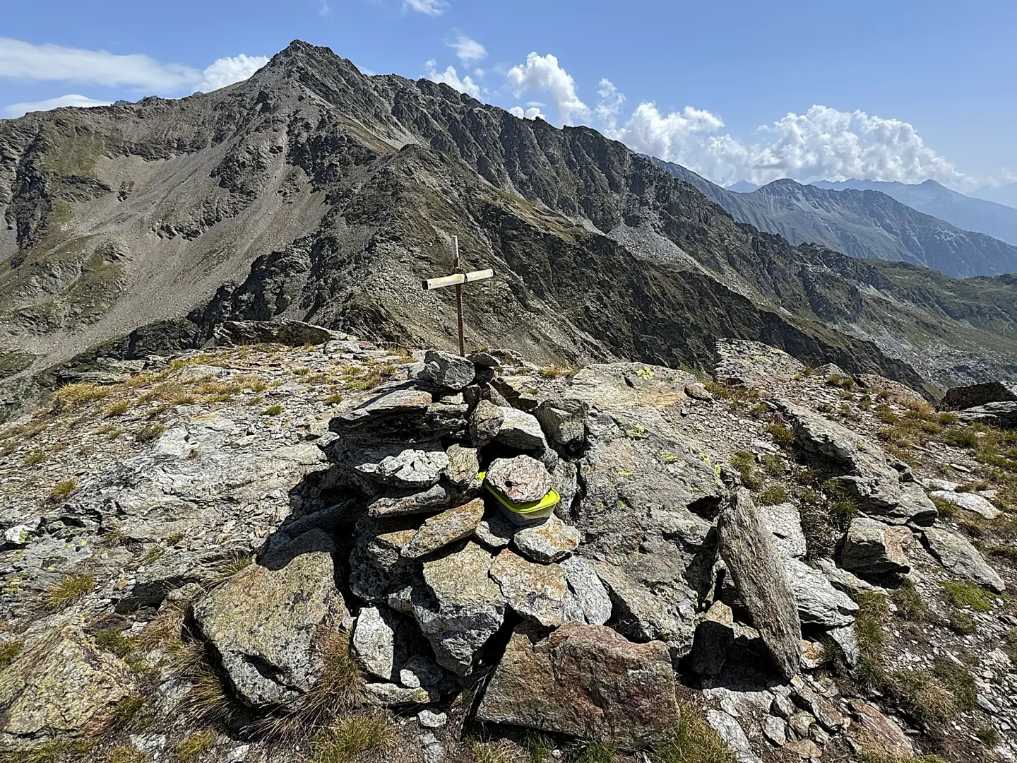
2h50' 5.52 km (1,042 m ascent) (10 m descent) From the pass, head left towards the south, staying on the ridge, tackling a couple of short sections where you’ll need to use your hands. First cross an area of boulders and grass, then go round a rocky outcrop on the left, taking care if the ground is damp or wet. Climb a few steps and return to the ridge until you reach the broad summit of the Tête de Barasson (2,729m), where you’ll find a cairn. [3h00’T3] 5.67km (1,089mD+)
The return journey follows the same route taken on the ascent. [1h45’ T2] 5.67 km (10 m elevation gain) (1,089 m elevation loss)
Comments (0)
Sign in to leave a comment